Diabase Dikes
How the ancient supercontinent Pangea may have helped create the Earth’s coal by Joel Hruska
The Norumbega Fault Zone, Maine: a mid- to shallow-level crustal section within a transcurrent shear zone,
by M. Hubbard, A. Ludman, C. Guidotti
Generation of felsic rocks of bimodal volcanic suites from thinned and rifted continental margins: Geochemical and Nd, Sr, Pb-isotopic evidence from Haida Gwaii, British Columbia, Canada
Made of Stone
The Schoodic International Sculpture Symposium sourced materials locally from the communities that participated in each event. The artists picked out the stone they would carve into, usually just before the Symposium started. This meant the materials were almost always part of the landscape before they became the sculptures they are today.
Active stone companies, motivated and intrigued by the project, donated large amounts of stone and often delivered the stone to the Symposium site. The sculptors visited these quarries and stone factories, finding blocks that inspired them and fit the dimension of their proposed work. The generosity of the stone companies helped offset the huge cost of materials, and ultimately made the five sculpture Symposia possible.
The geology of Maine made this granite a local resource, and because it is such a big part of the trail, it deserves a closer look. Read more about interesting facts regarding Maine’s unique landscape below. For a full discussion and to see our educational posters, visit our education webpage.
Maine Geology
The Acadian Orogeny
The geologic story of the various types of stone used in the symposium’s sculptures is an interesting and complex one. It begins over 400 Million Years Ago during the Devonian Period when a micro-continent geologists refer to as Avalonia collided with the ancestral North American continent. This collision is referred to by geologists as the Acadian Orogeny, where the term orogeny is used to describe a tectonic event that gives rise to mountain chains. For example, the ongoing collision between India and Asia continues to push the Himalayas to new heights. It was during this collision that the granites and gabbros we find today along the coast of Maine formed at great depths within the Earth.
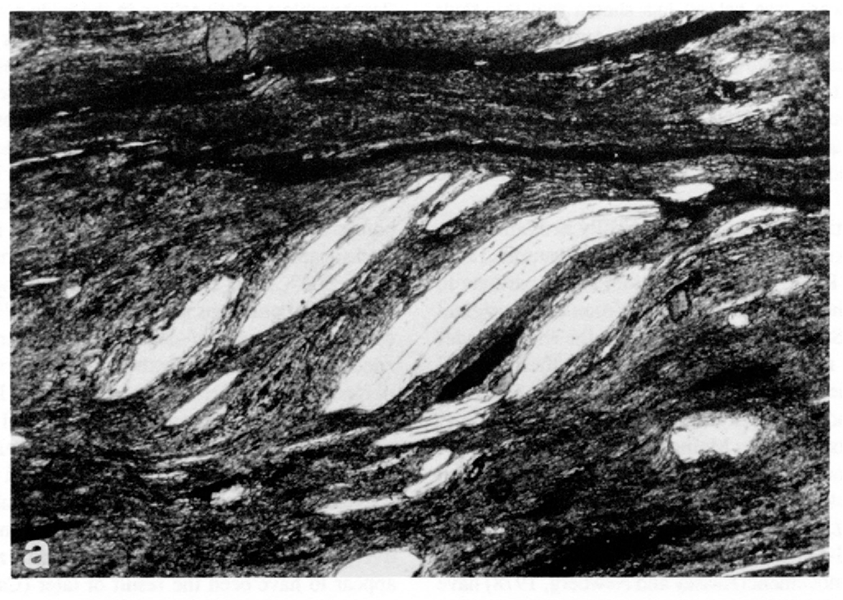
The Norumbega Fault, which trends ENE from Portland to Bangor and continues across the Canadian border north of Calais, represents the suture zone delineating the former margin between these continents. Interstate 95 roughly follows the trend of this fault. The southeast side of this fault is called the Avalon Terrane, and comprises most of Maine’s coastal bedrock. You will see examples of this bedrock in sculptures that incorporate granite and gabbro from nearby quarries.
Pangea – The Supercontinent
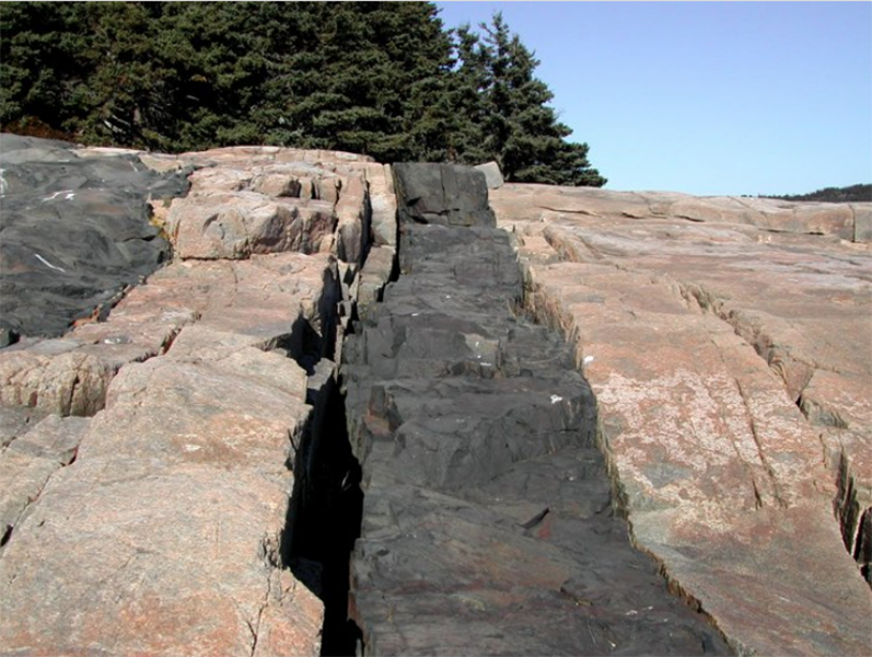
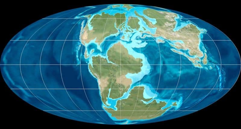
By 260 Ma, Earth’s continents had converged to form a supercontinent Pangea, which was centered at the equator (see figure above). At the end of the Permian period about 245 Ma, a mass extinction event wiped out approximately 90% of animals and plants living on Earth at that time (Caldwell, 1998). This paved the way for dinosaurs to emerge during the Triassic period about 230 Ma. During the Jurassic around 200 Ma, rift zones began to split Pangea apart to eventually form the continents as we know them today. The Atlantic Ocean began opening along one of these rift zones, and split rocks from the Avalon Terrane to both sides of the Atlantic. This rifting produced massive eruptions of basalt, and the evidence is preserved as basalt and diabase dikes in Avalonian coastal bedrock at various locations in Maine. Schoodic Point has some excellent examples of diabase dikes (see figure at the bottom of this webpage). The dikes formed as molten lava erupted into pre-existing fractures and joints in the granitic bedrock. The opening of these fractures was certainly helped by the tectonic rifting that split Pangea and the Avalon Terrane apart. Maine has no geologic record from the period after the rifting of Pangea (200 Ma) up to the last ice age which began 40,000 years ago, because those rocks were eroded away by time and multiple ice ages (Caldwell, 1998).
A quick word about granite, gabbro, and basalt:
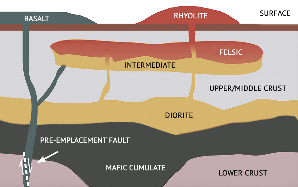
These are igneous rocks, or rocks that have formed from molten magma originating from the Earth’s mantle. Granite and gabbro are “intrusive” rocks that formed and cooled deep within the Earth, and basalt is an “extrusive” rock that erupted from volcanoes or rift zones as lava and cooled at the surface. Intrusive rocks are visible at the Earth’s surface because of tectonic events that uplift or raise the crust (such as an orogeny event) in concert with the erosion of overlying rocks and unconsolidated materials. Basalt and gabbro are related in that they are both “mafic” in composition, which means these rocks are rich in magnesium and iron bearing minerals, and this also gives these rocks their dark color. Granite on the other hand is “felsic” in composition or rich in silicate bearing minerals, which gives granites their characteristically lighter or grayish colors. Mafic rocks originate from the Earth’s mantle and associated with oceanic crust, and felsic rocks are the result of magma from the mantle mixing and melting silicate rich continental crust (see above figure).


